

Video
Foto
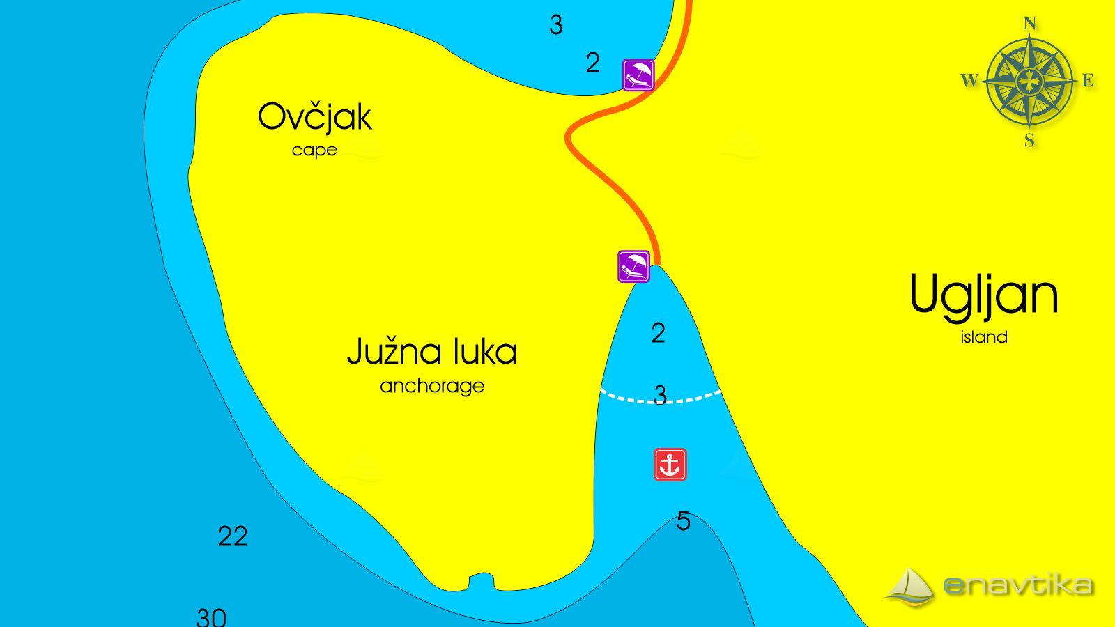
Južna luka
Ugljan
 Sidrište
Objavil(a) eNavtika
Podaci
| GPS | 44° 7' N , 15° 4' E |
| Benzinska postaja | 9 nmi Zadar |
| Dubina vode | 2 - 5 m |
| Mjesto | Otok Ugljan |
| Radno vrijeme | 1.1. - 31.12. |
| Broj vezova | 0- sidranje na lastnem sidru |
Info
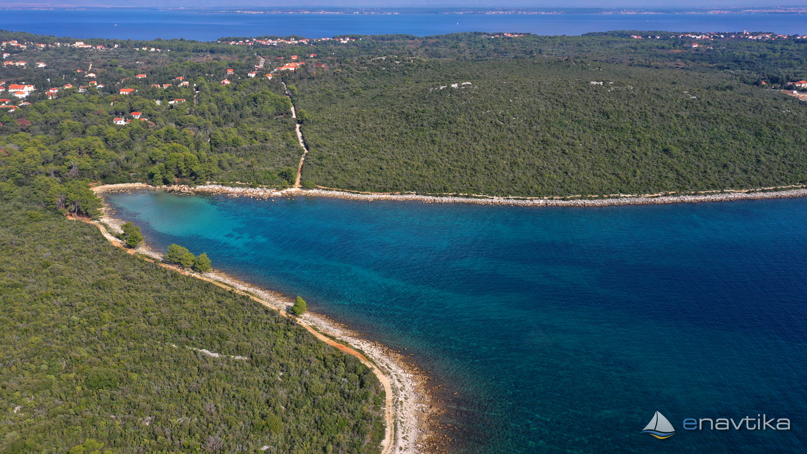
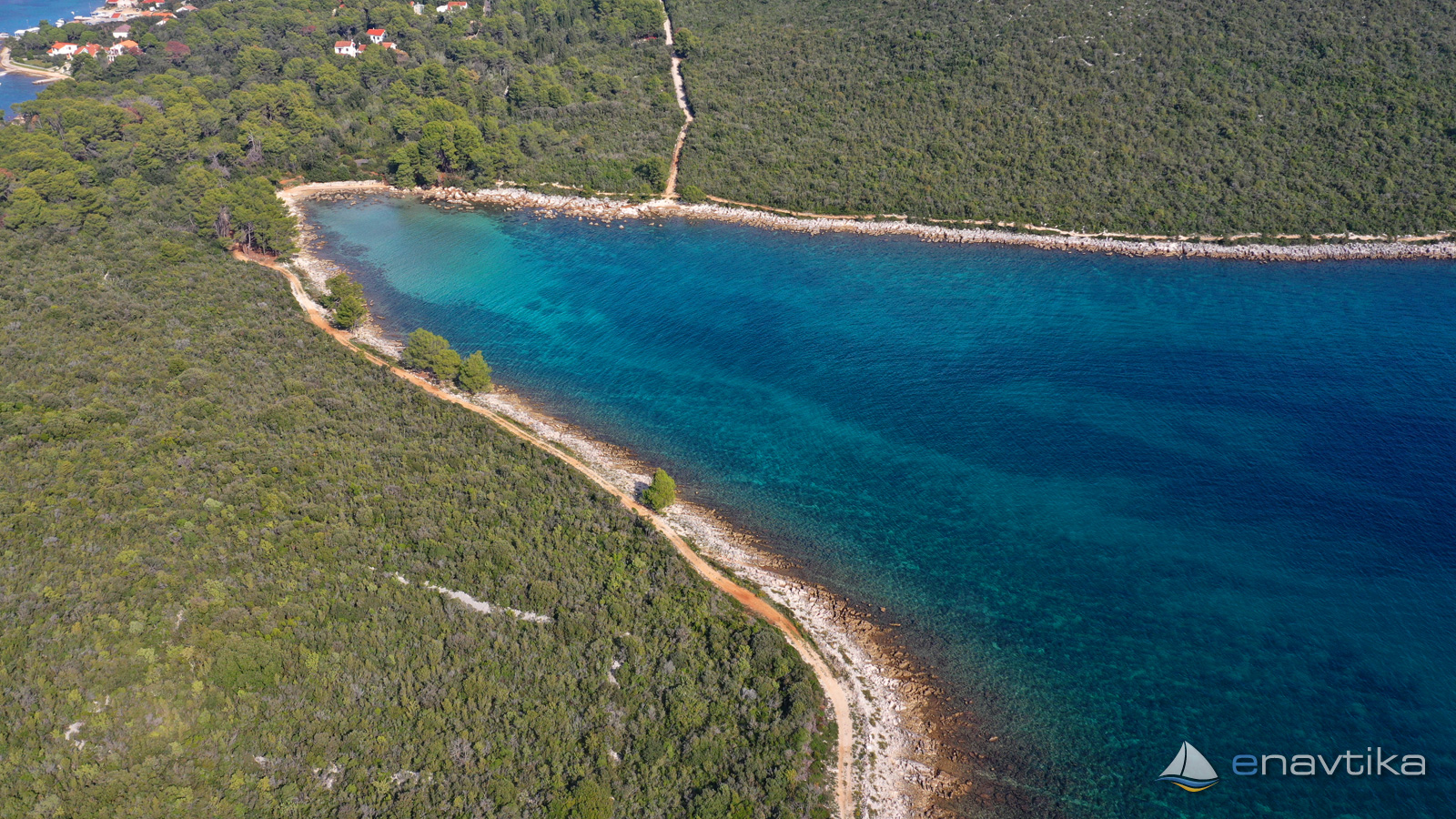
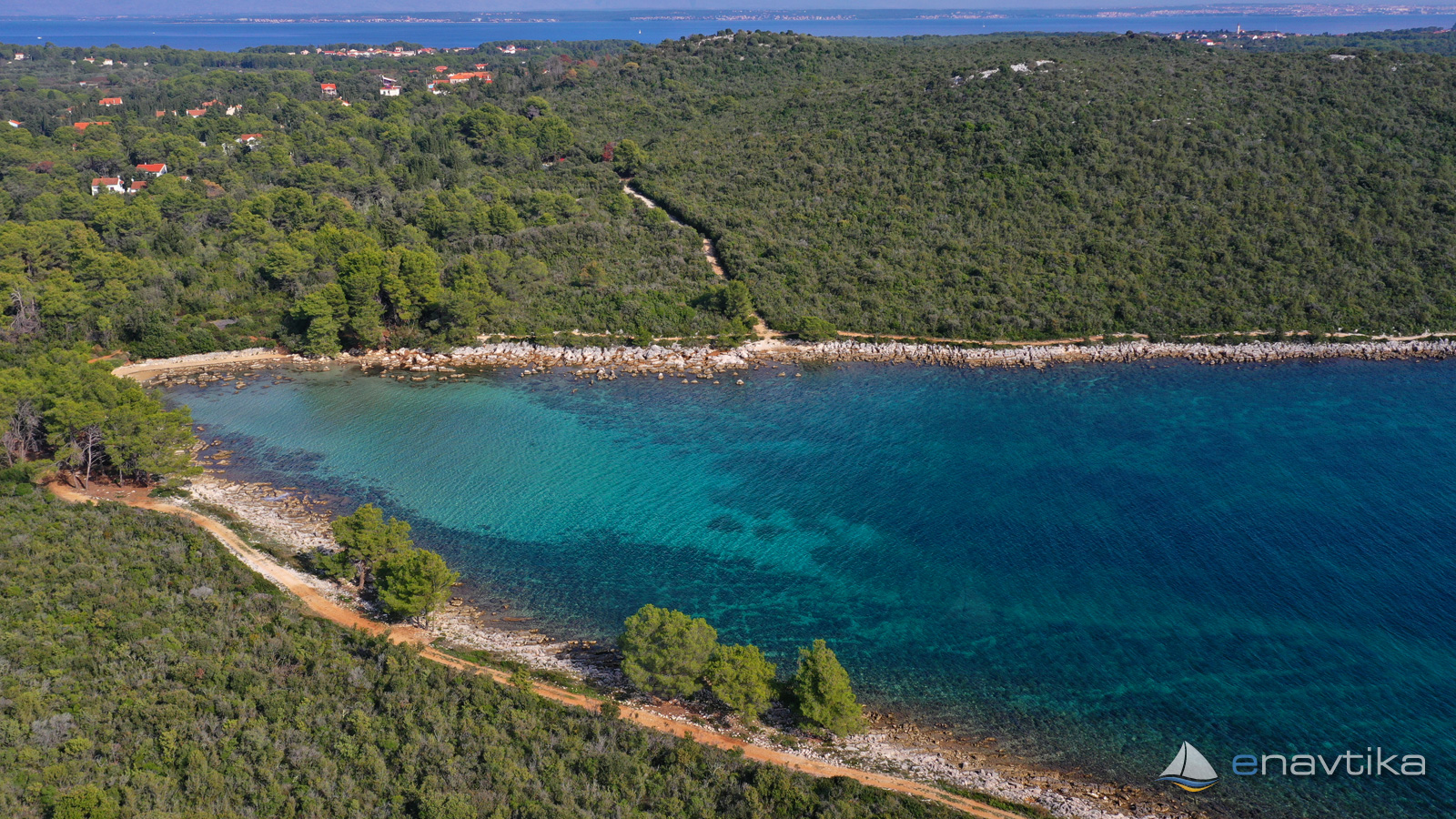
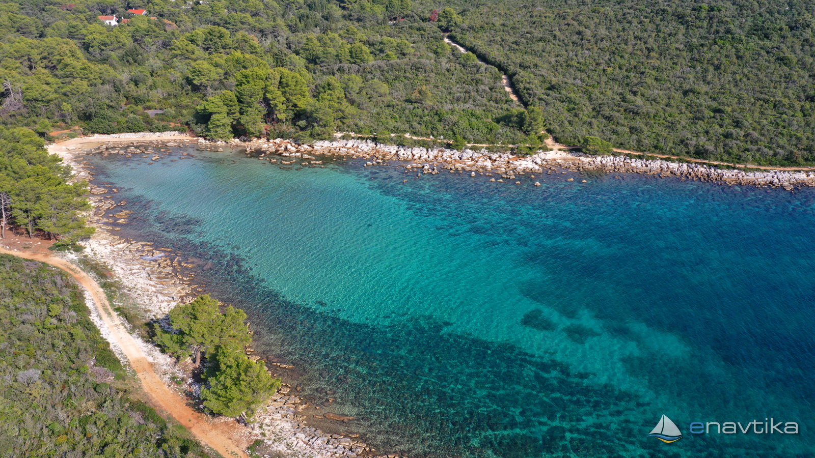
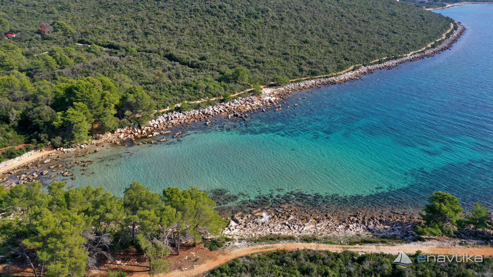
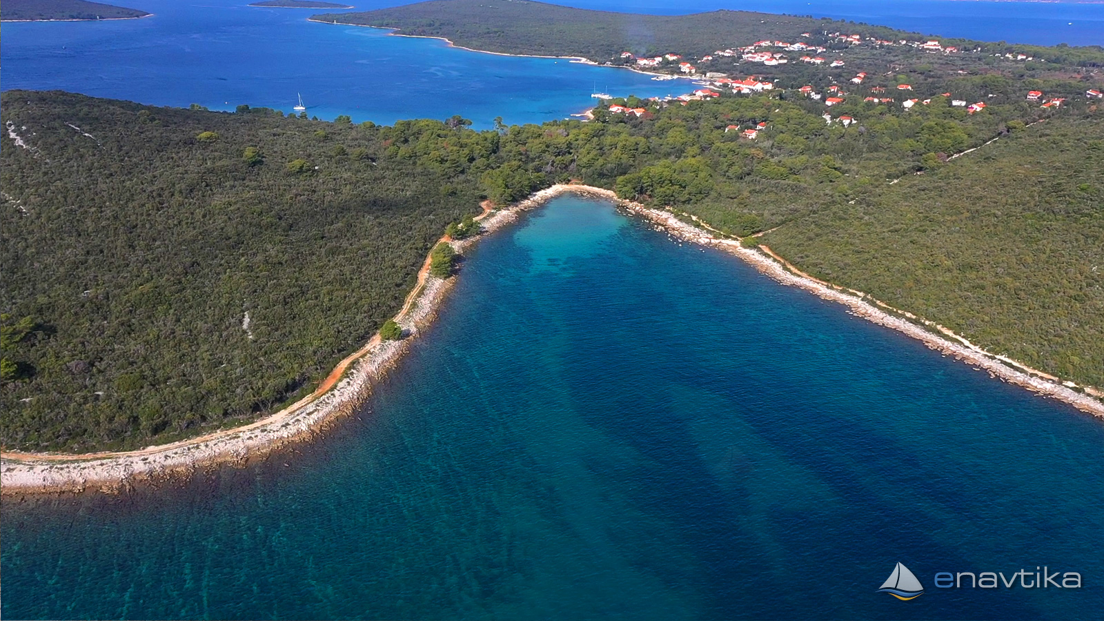
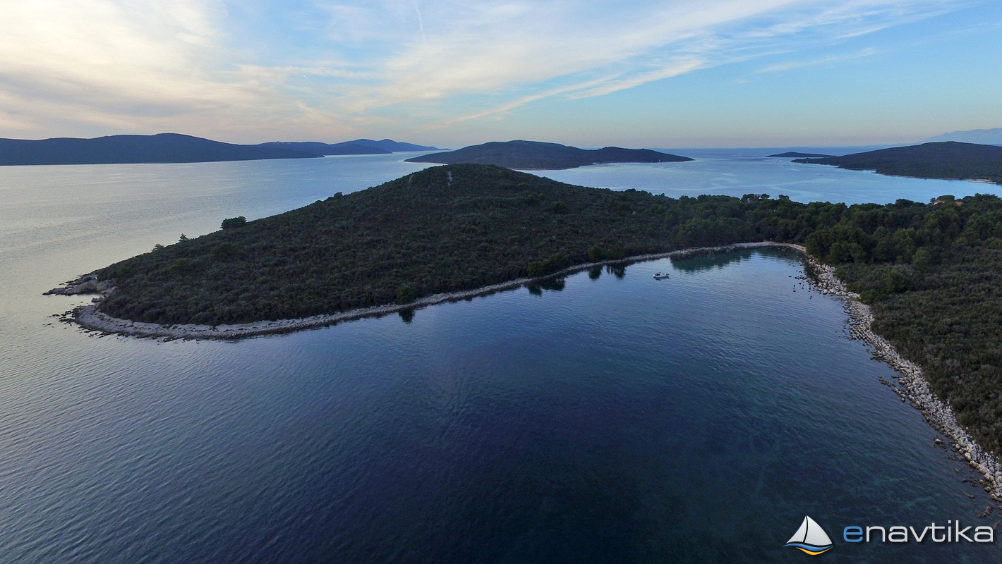
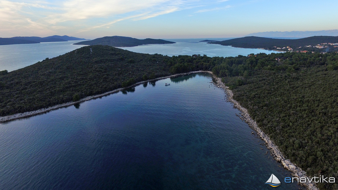
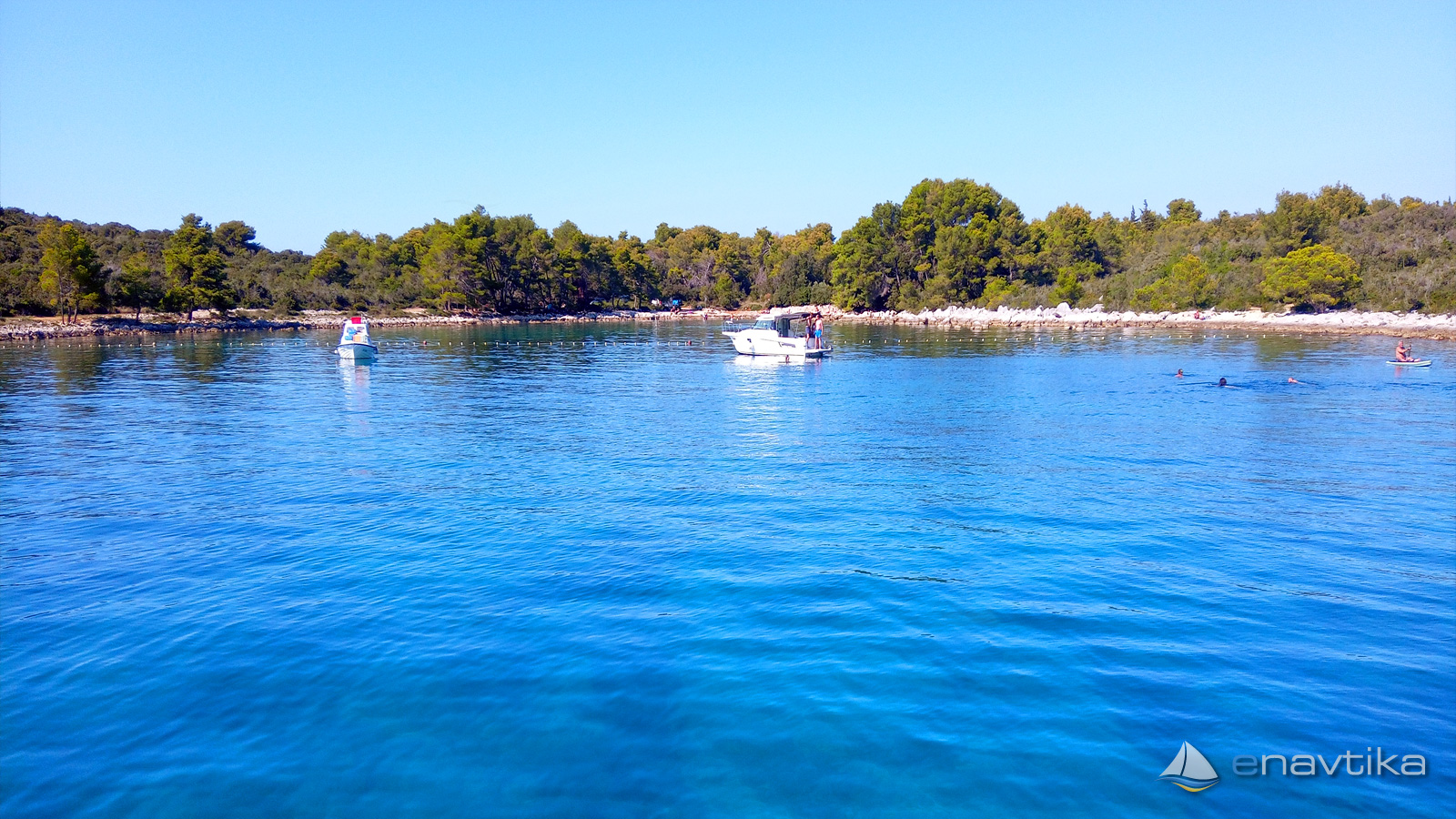
Anchorage South Port is on the northwest side of the island of Ugljan. The bay is well protected from all winds except the south. We can anchor at depths between 2 and 5 m. The bottom is sandy in the middle of the bay and rocky towards the shore. Part of the bottom is covered with marine vegetation. In the sandy part, the anchor holds well. Due to the extremely beautiful turquoise color of the sea, the bay is very popular. During the summer season, tourist cruise ships anchor in it. There is no supply in the bay. The nearest inn, shop and bar are in the port of Muline, which can be reached in about 700 m on foot or a 10-minute walk.
Zaštita od vjetra/Vrijeme

Danas
- čv
Sutra
- čv
Srijeda
- čv
U blizini
-
 Zmorašnja luka
Sidrište
0.26 nmi
Zmorašnja luka
Sidrište
0.26 nmi
-
 Muline
Luka
0.35 nmi
Muline
Luka
0.35 nmi
-
Pavlešina
Luka
0.45 nmi
Zaštićeno
- Zmorašnja luka Sidrište 0.26 nmi
- Muline Luka 0.35 nmi
- Sušica Luka 1 nmi

Cijene
| 09.10.2016 | 0,0 HRK /m/dan |

Komentari