


Luka od Svršate
Vela Svršata
 Sidrište
Podaci
| GPS | 43° 51' N , 15° 16' E |
| Broj vezova | 0 |
| Dubina vode | 2 - 10 m |
| Radno vrijeme | 1.1. - 31.12. |
| Benzinska postaja | 7 nmi Zaglav (Dugi otok) |
| Mjesto | Vela Svršata |
Info
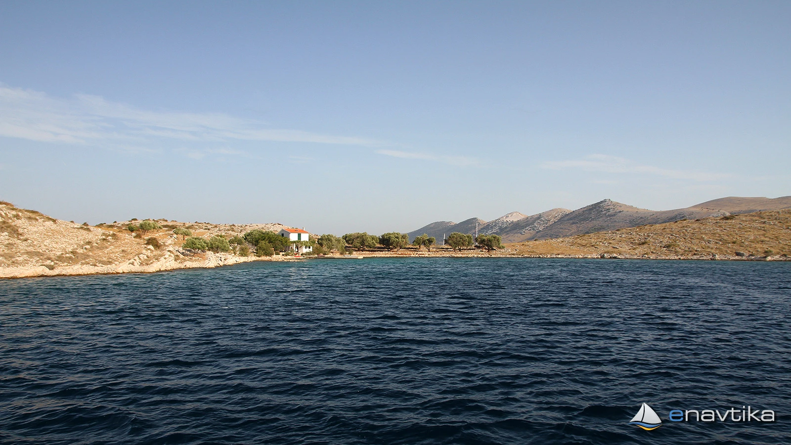
The island of Vela Svršata lies between the islands of Kornat to the west and Žut to the east. The island has a beautiful bay on the northern side, which is well protected from southern winds. Waves are caused only by winds from the north. The bottom of the bay is sandy and anchors hold well. We can anchor at depths between 2 and 7. In the southeastern part of the bay there is a house, in front of which there is a private concrete pier, and 20 m north of it there is an old stone pier, which has been demolished. In the western part of the bay there are underwater remains of a stone building. Anchoring in this part of the bay is not recommended.
You can safely sail between the island of Vela Svršata and Kornat (Cape Statival). The depth in the middle of the passage is 7m. The island belongs to the Kornati National Park, so you have to pay an entrance fee. There is no additional fee for anchoring.
Zaštita od vjetra/Vrijeme

Danas
- čv
Sutra
- čv
Nedjelja
- čv
U blizini
-
 Vela Svršata West
Sidrište
0.17 nmi
Vela Svršata West
Sidrište
0.17 nmi
-
Gornji Statival
Sidrište
0.46 nmi
-
Donji Statival
Sidrište
0.77 nmi
Zaštićeno
- Vela Svršata West Sidrište 0.17 nmi
- Gornji Statival Sidrište 0.46 nmi
- Donji Statival Sidrište 0.77 nmi

Cijene
| 08.01.2018 | do 11 m 300,00 HRK/dan |
| 08.01.2018 | do 18m 540,00 HRK/dan |
| 08.01.2018 | do 25 m 720,00 HRK/dan |

Komentari