

Foto
Kalebinjak ID
Šibensko-Kninska
 Oznaka
Objavil(a) eNavtika
, 03.01.2021
Podaci
| GPS | 43° 30' N , 15° 56' E |
| Benzinska postaja | 1 nmi Rogoznica |
| Mjesto | Kalebinjak (Rogoznica) |
| Karakteristika | W Fl(2) 10s 7m 3M |
Info
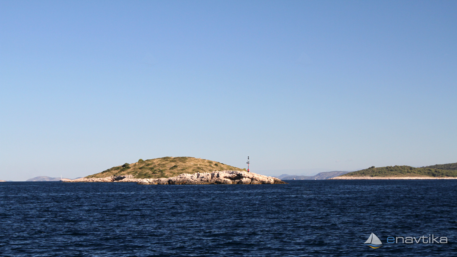
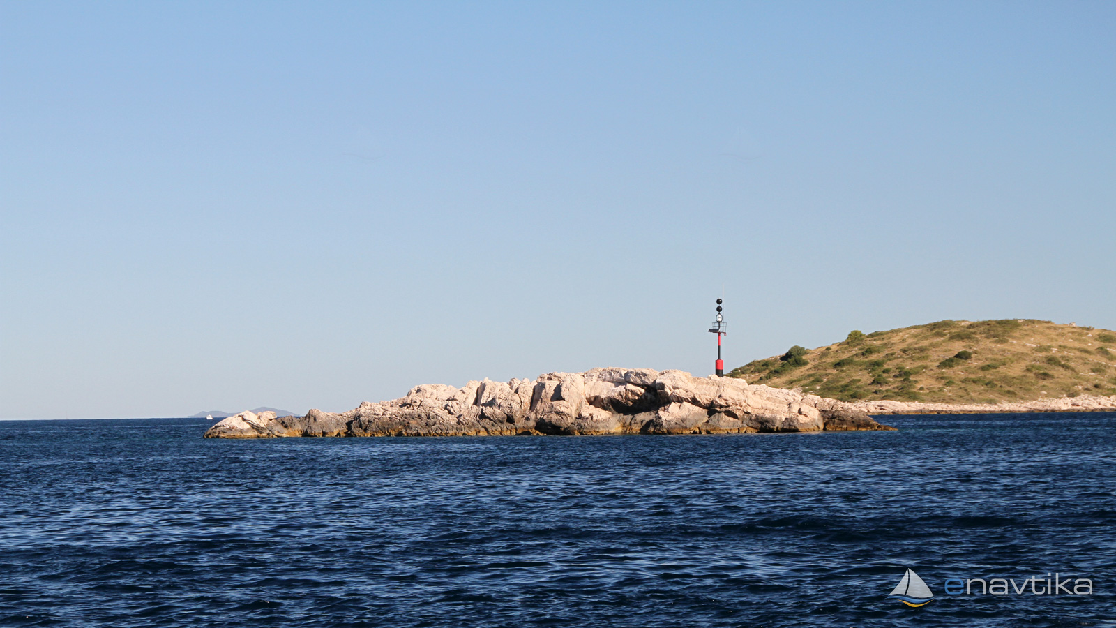
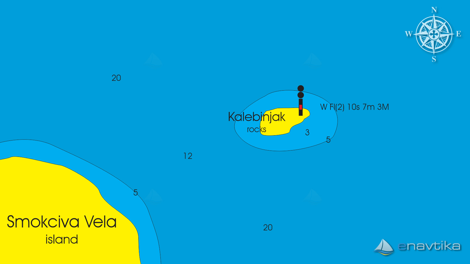
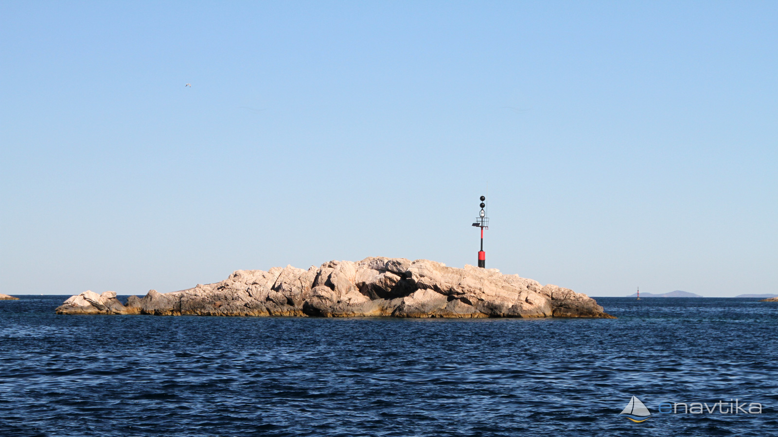
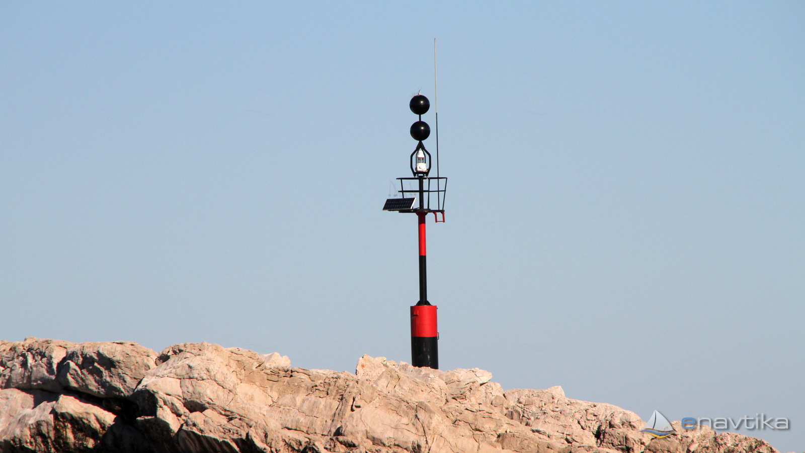
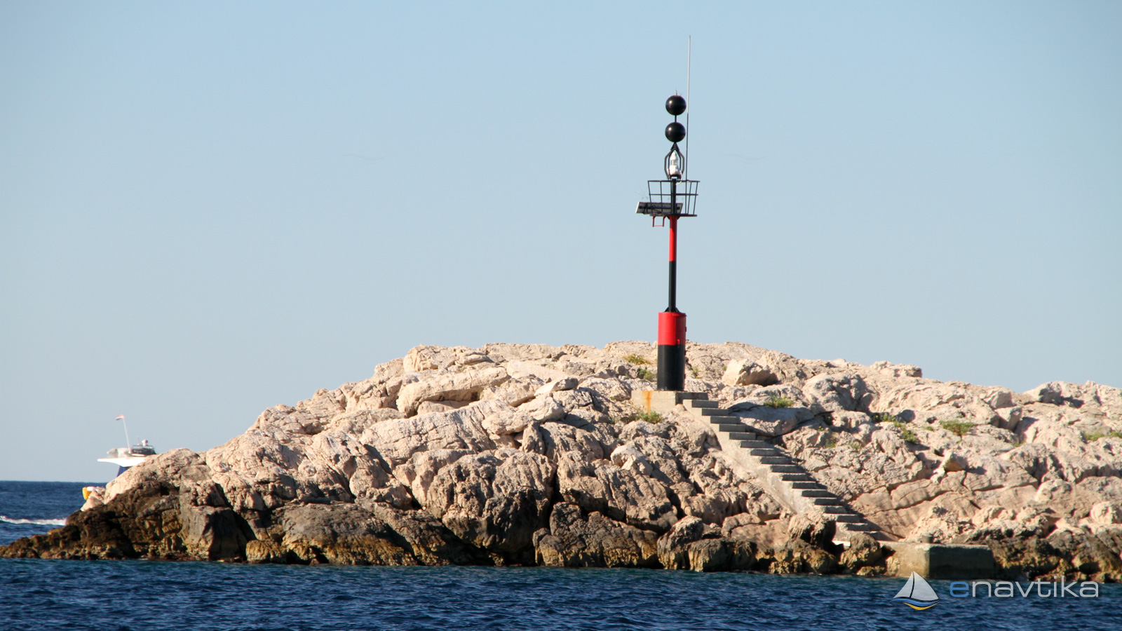
Isolated danger mark stands on the small island Kalebinjak between island Smokvica Vela, Smokvica mala and capes Konj and Movar. Navigation 50 from the mark is safe in all directions. Water depths are over 10 m. Between island Kalebinjak and Smokvica Vela water depth is 12 m. Characteristic of the light is W Fl(2) 10s 7m 3M.
Vrijeme
Danas
- čv
Sutra
- čv
Subota
- čv
U blizini
-
 Smokvica Vela
Luka
0.23 nmi
Smokvica Vela
Luka
0.23 nmi
-
 Konj G
Svjetionik
0.29 nmi
Konj G
Svjetionik
0.29 nmi
-
 Movar
Sidrište
0.5 nmi
Movar
Sidrište
0.5 nmi
Komentari