
Foto
Osor LL 1
Lošinj
 Oznaka
Objavil(a) eNavtika
, 01.11.2021
Podaci
| GPS | 44° 41' N , 14° 23' E |
| Dubina vode | 3 m |
| Mjesto | Osor |
Info
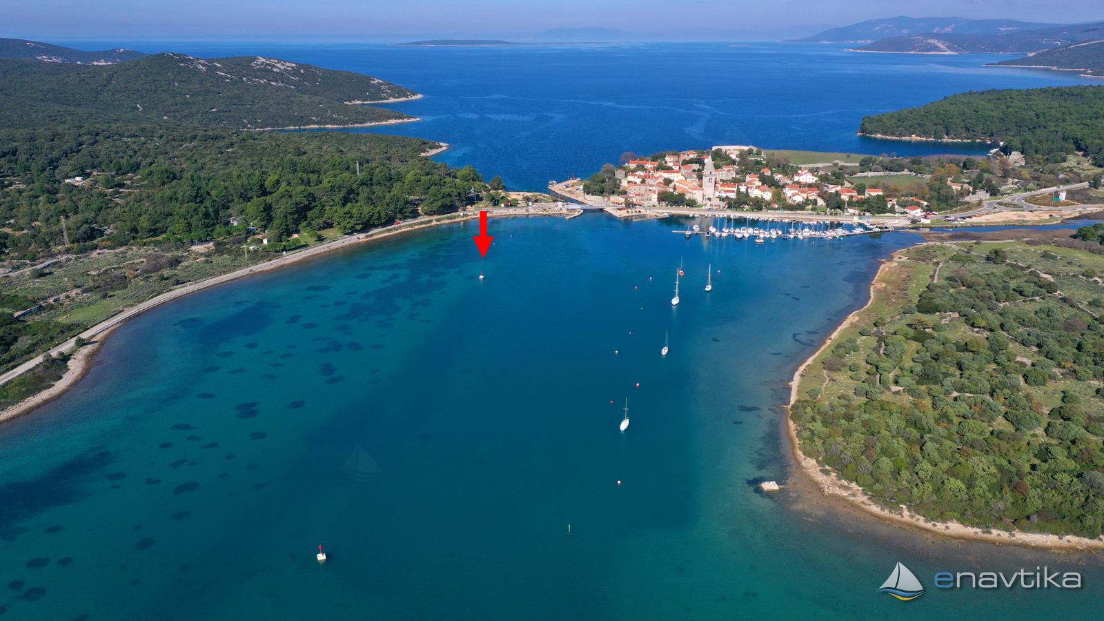
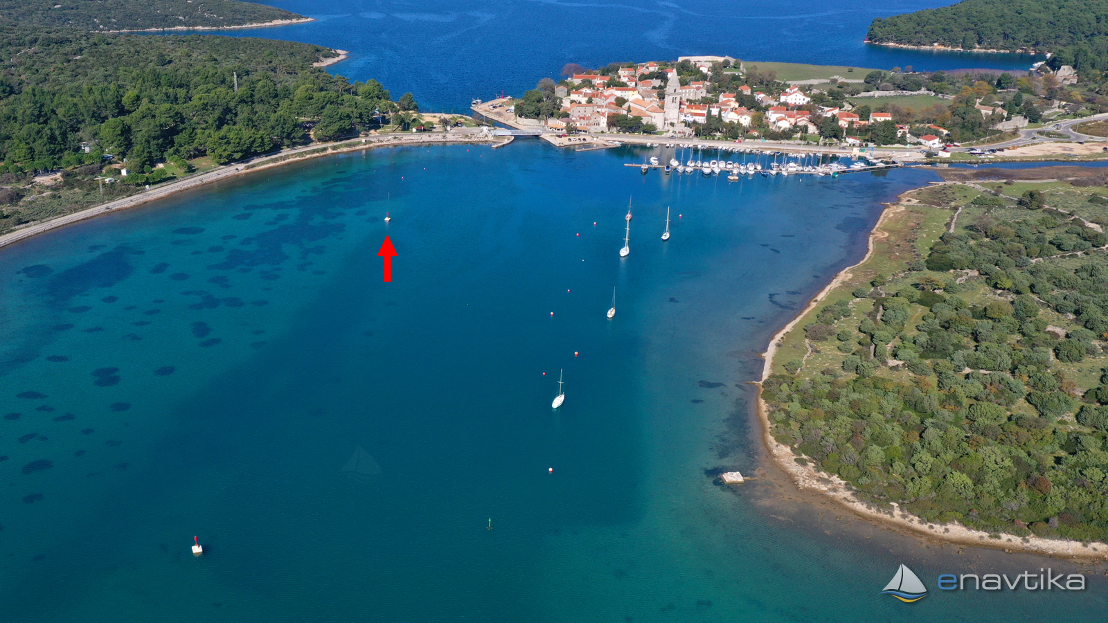
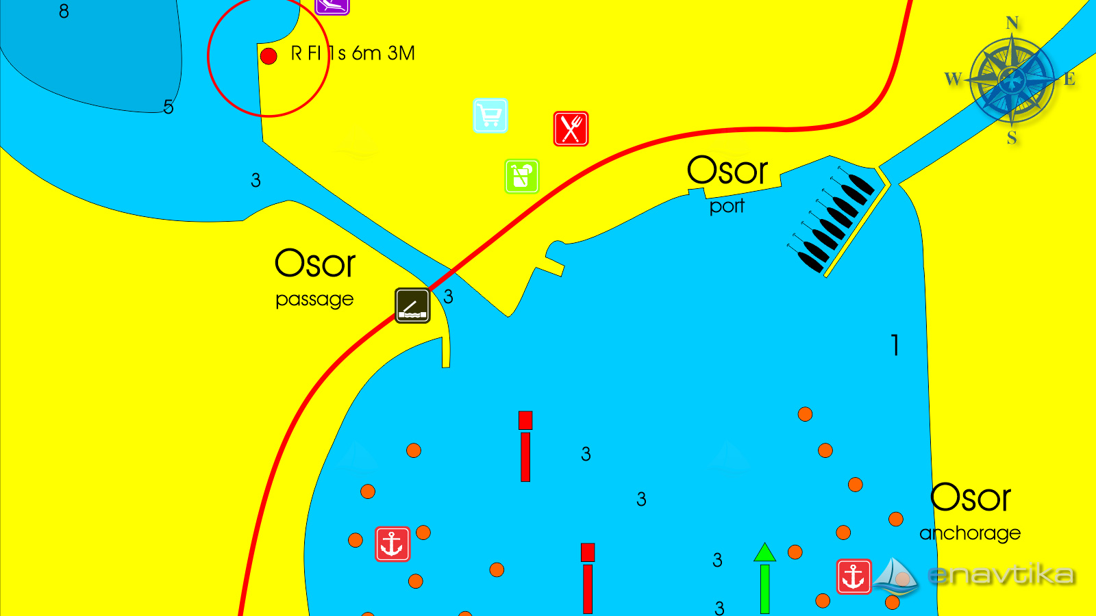
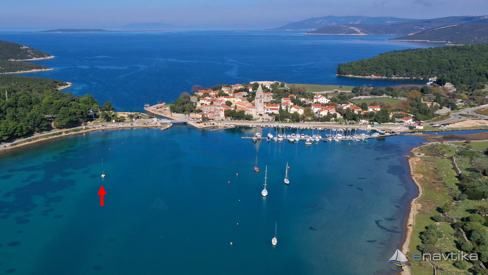
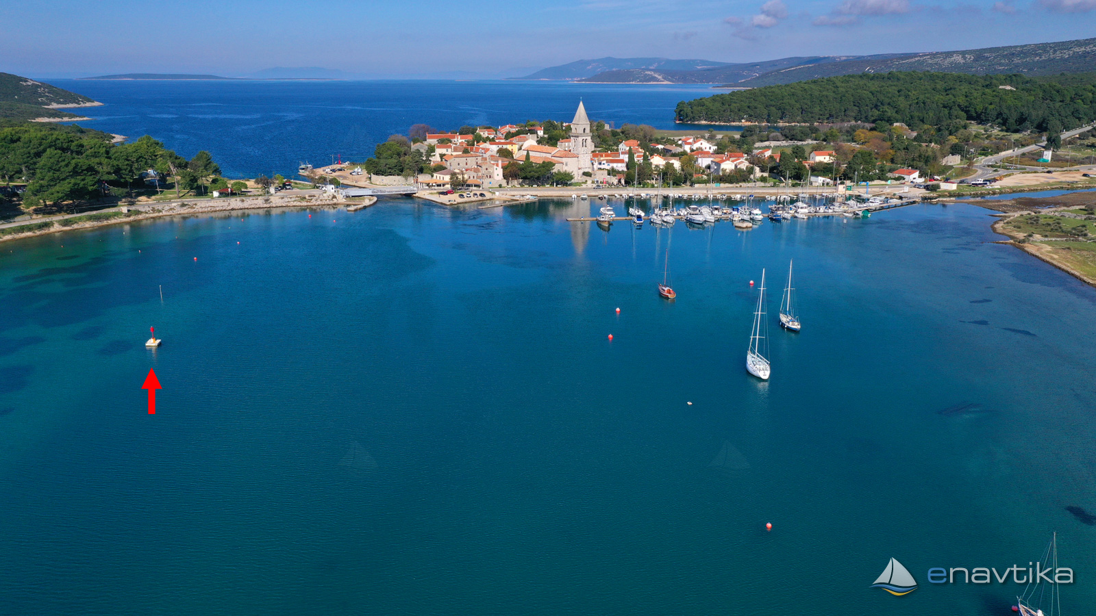
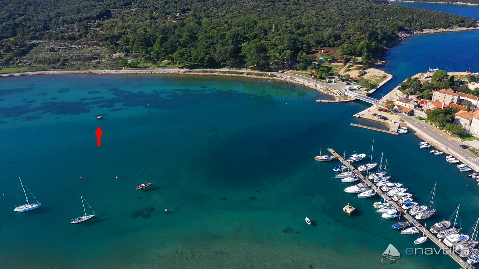
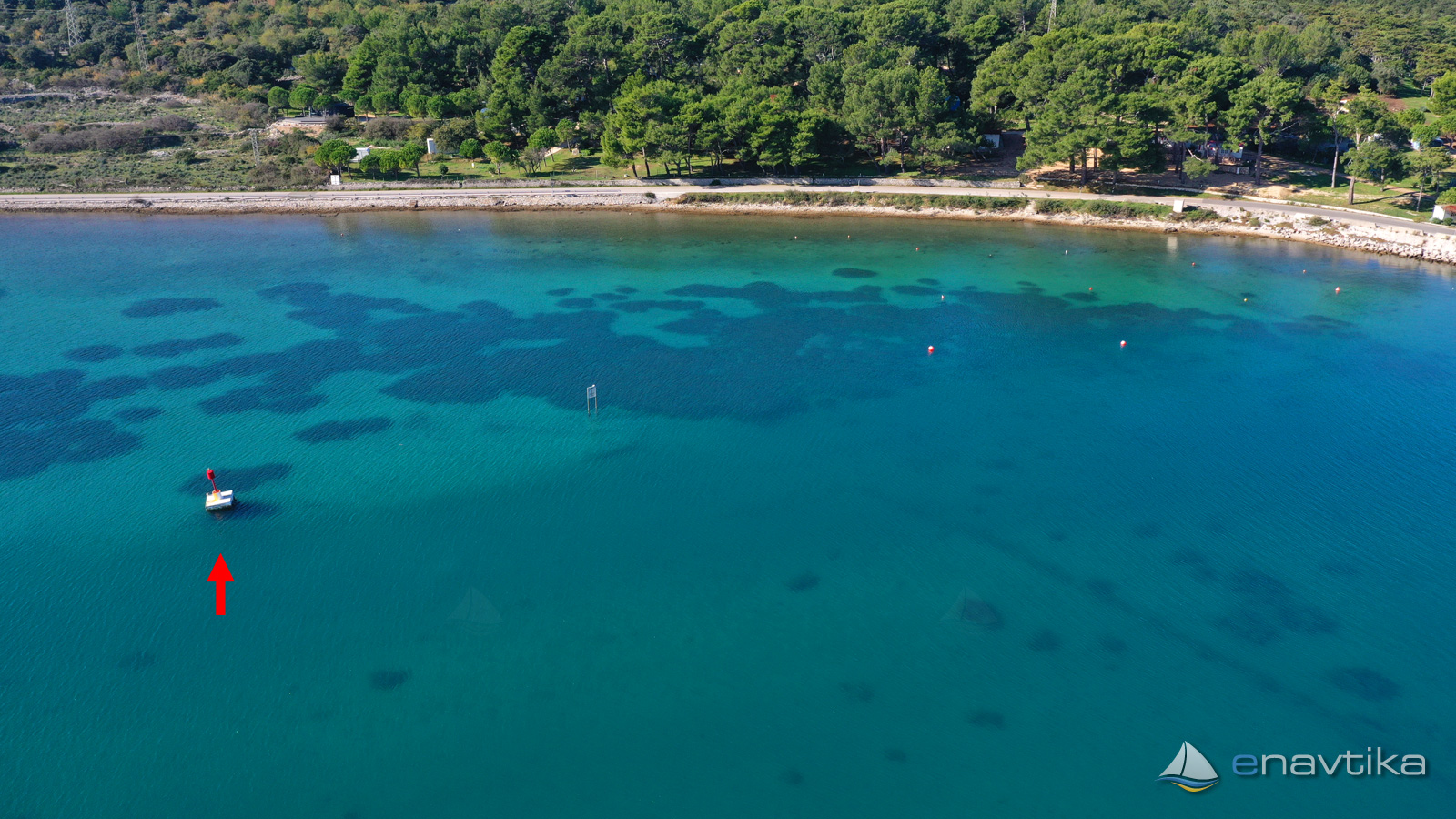
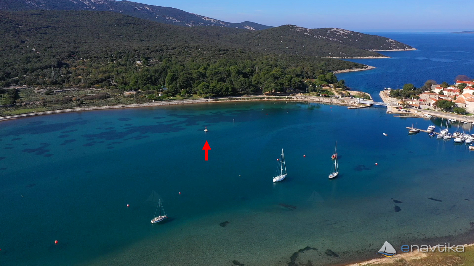
Lateral mark of left side stands 150 m south from Osor passage between island Lošinj and Cres. Red iron construction is 2 m high. Mark doesn't emit any light. On the top of the mark is a red cylinder. When navigating from the south side to the passage, leave the mark on your left. Water depth west of the mark is less than 3m and quickly drops to 1 m near the shore. East os the mark is artificially deepened channel with water depth of 3 m.
Vrijeme
Danas
- čv
Sutra
- čv
Petak
- čv

Komentari