

Foto
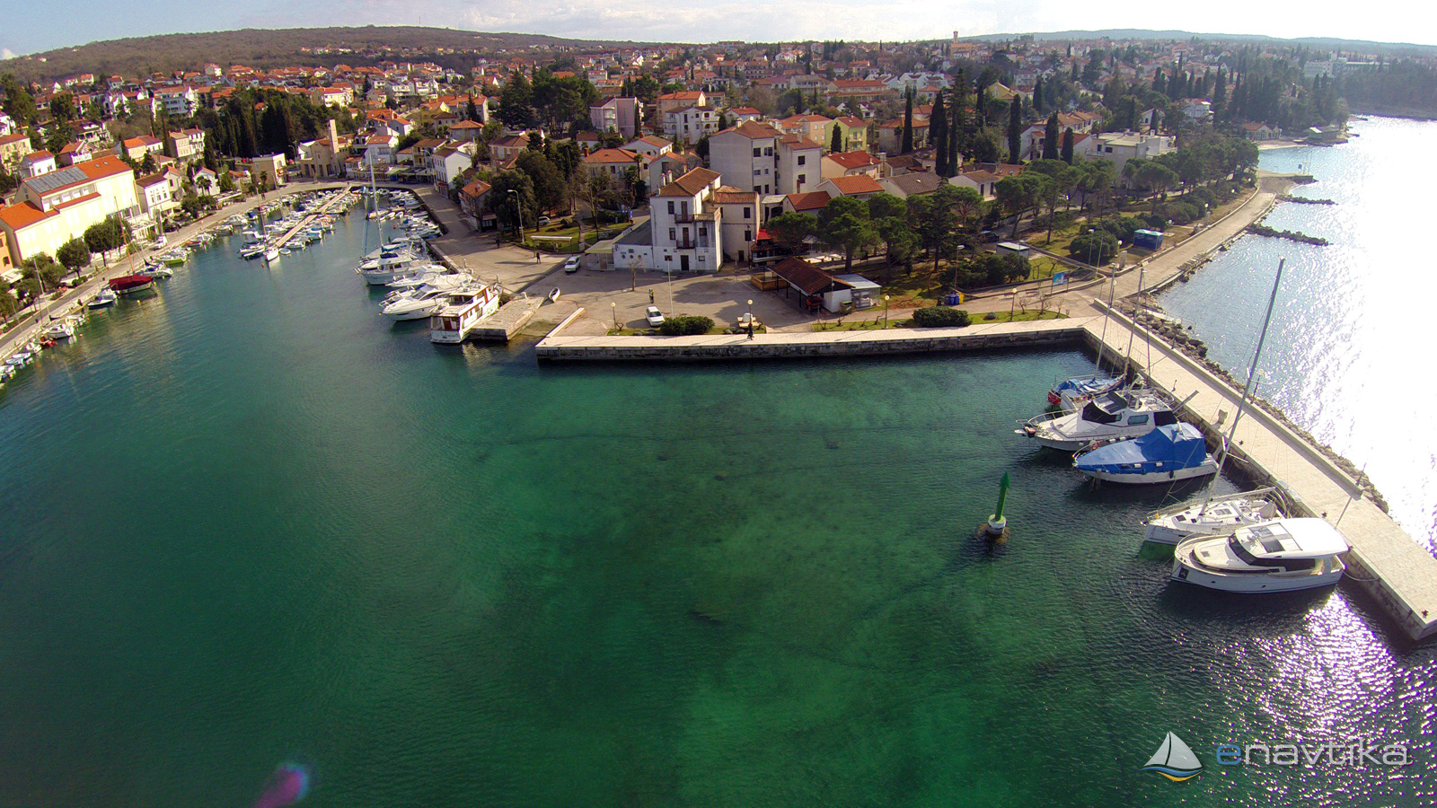
Malinska LR
Krk
 Oznaka
Objavil(a) eNavtika
, 12.02.2019
Podaci
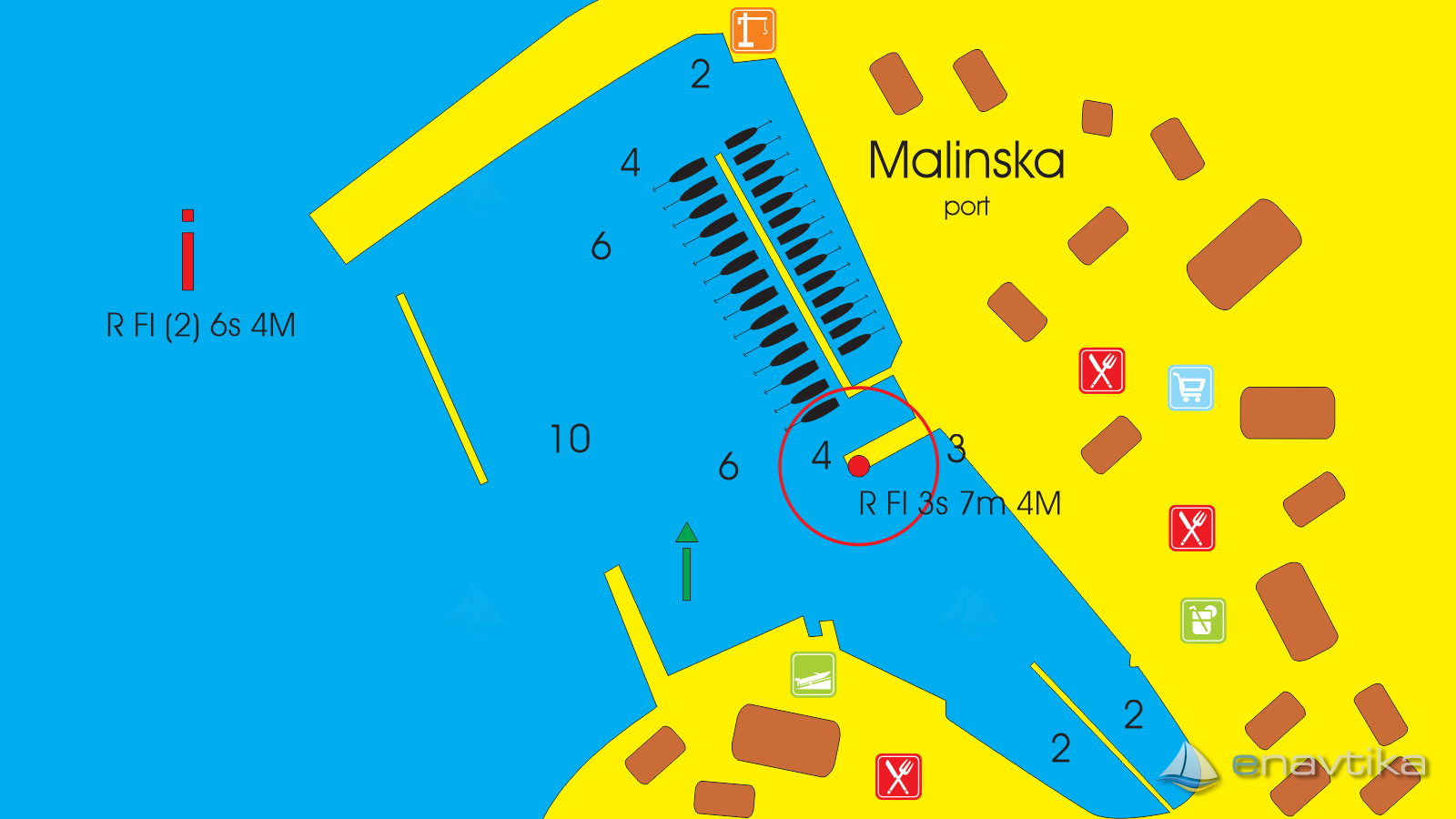
| GPS | 45° 7' N , 14° 31' E |
| Dubina vode | 2 m |
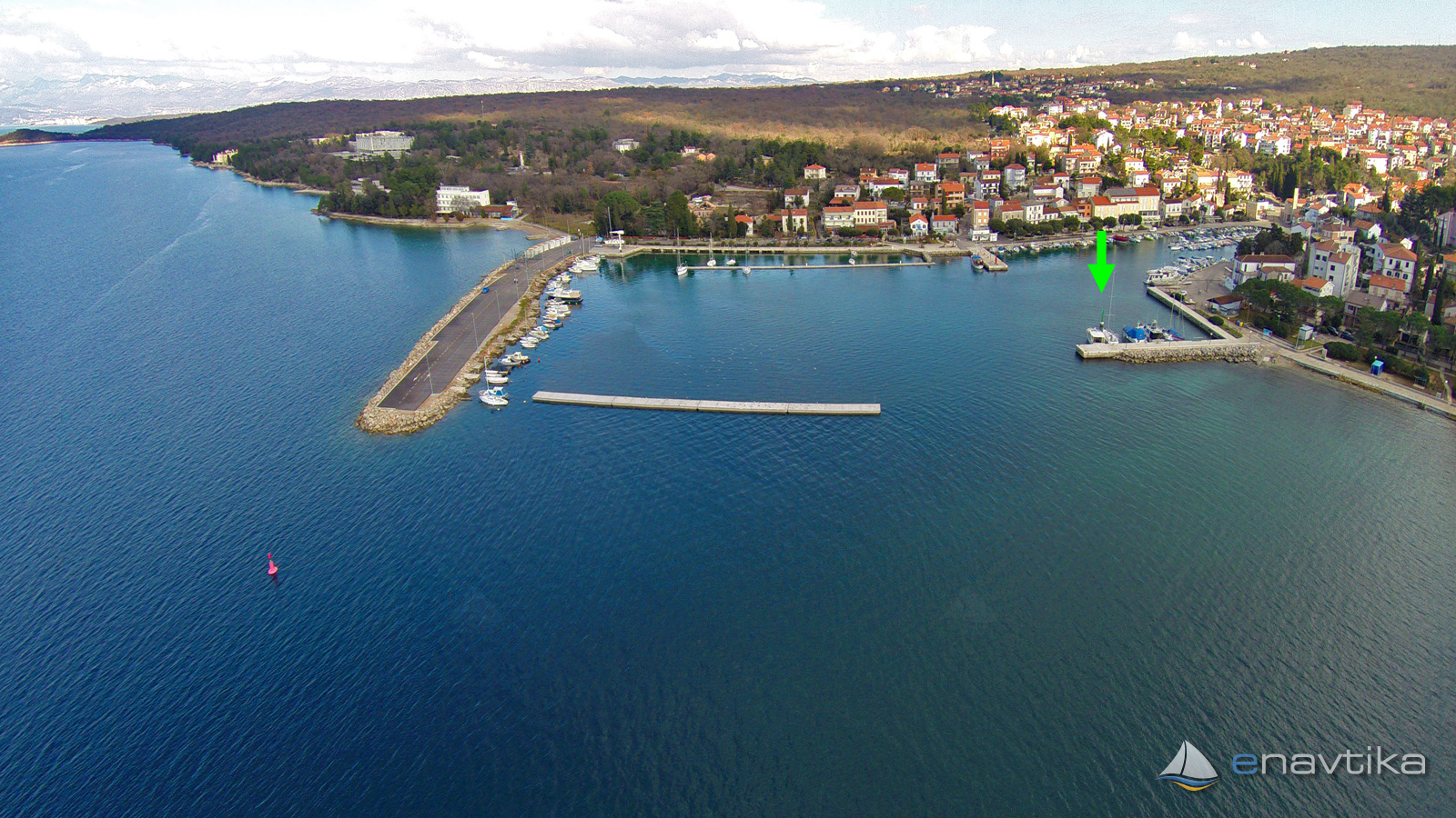
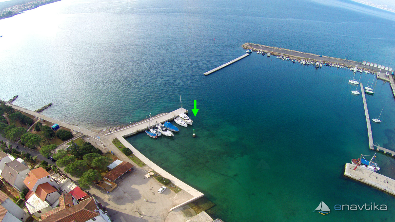
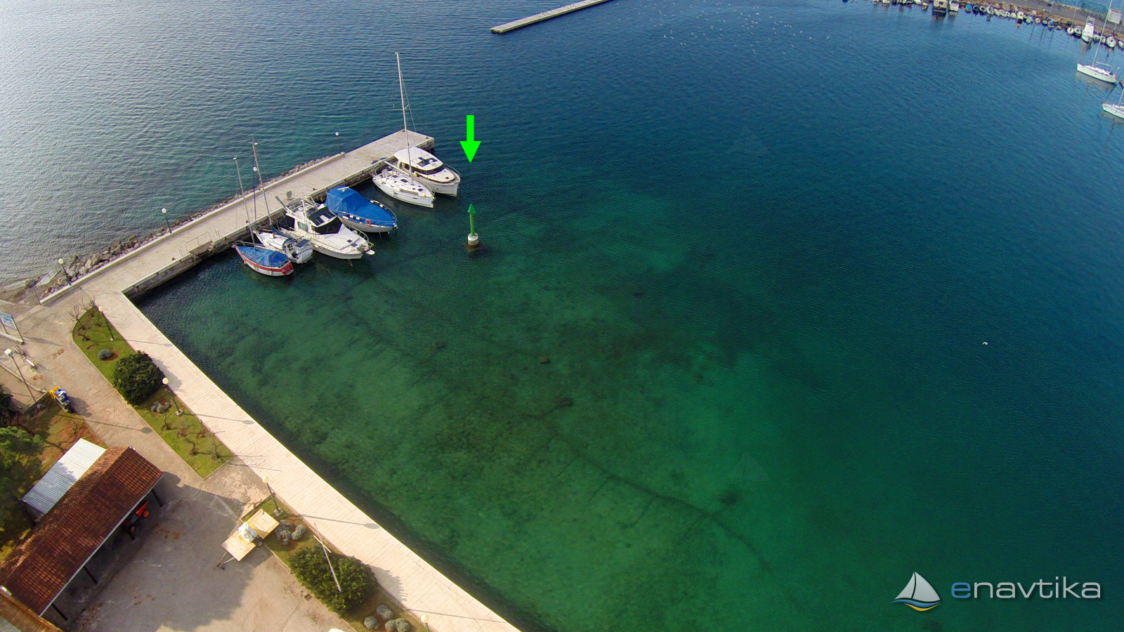
| Mjesto | Malinska, Krk |
Info
Lateral mark "RIGHT" in 20 m from the head of south wave breaker of port Malinska on island Krk. Green iron mark is 2 m high and marks the edge of shallow waters south from the mark. Wren navigating into southeast part of port, leave the mark on your right. Water depth south of the mark is less than 2 m.
Vrijeme
Danas
- čv
Sutra
- čv
Srijeda
- čv
U blizini
-
 Malinska Luka
Luka
0.02 nmi
Malinska Luka
Luka
0.02 nmi
-
 Malinska E2868
Svjetionik
0.05 nmi
Malinska E2868
Svjetionik
0.05 nmi
-
 Malinska
Lučka kapetanija
0.07 nmi
Malinska
Lučka kapetanija
0.07 nmi
Komentari