
Foto
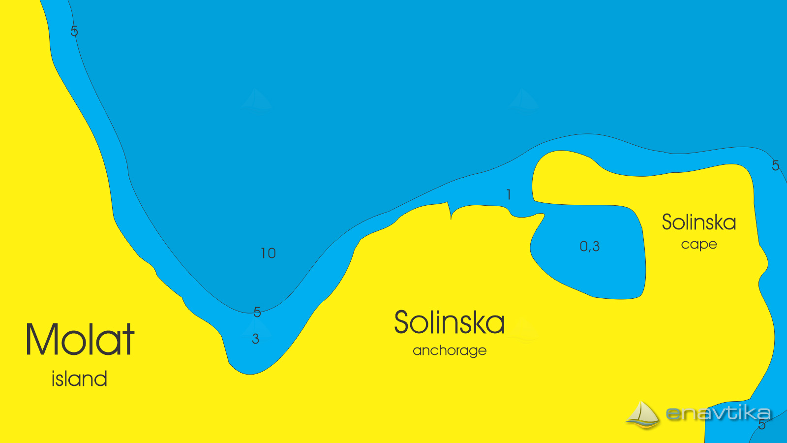
Solinska
Molat
 Sidrište
Objavil(a) eNavtika
, 28.01.2023
Podaci
| GPS | 44° 14' N , 14° 49' E |
| Broj vezova | 0 |
| Dubina vode | 2 - 10 m |
| Radno vrijeme | 1.1. - 31.12 |
| Mjesto | Zapuntel, Molat |
Info
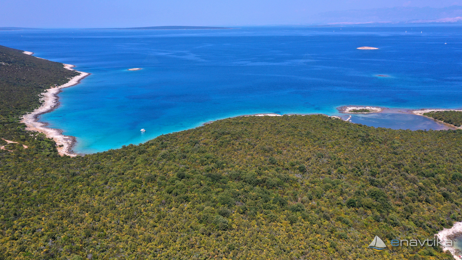
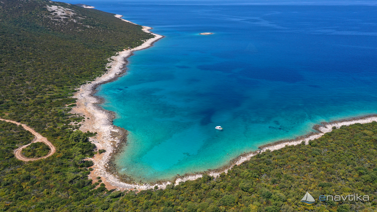
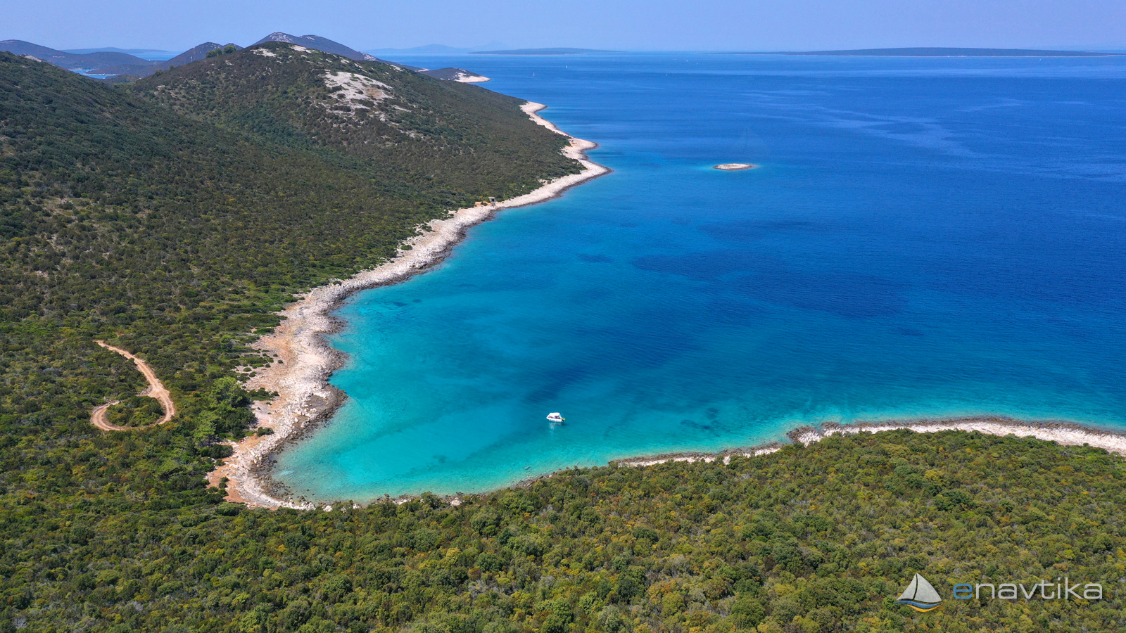
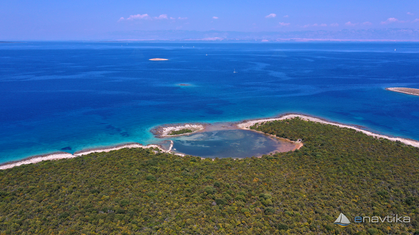
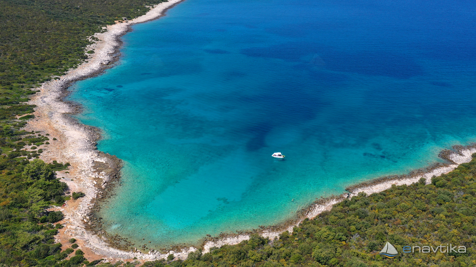
Solinska Bay is on the northeastern side of the island of Molat. The bay is well protected from south and west winds. It is open to northerly winds. It is not suitable for anchoring in the event of a storm. Sea depths are between 2 and 10 m. The bottom is sandy and rocky towards the coast. The anchor holds well in the sandy part. On Cape Solinski there is a small lagoon into which it is not possible to navigate, the depth is only around 0.5 m.
A macadam road leads to the bay from Zapuntel. In the summer time, bathers come to the bay, but they leave the bay towards evening.
Zaštita od vjetra/Vrijeme

Danas
- čv
Sutra
- čv
Petak
- čv
U blizini
Zaštićeno
- Luka Jazi-Molat Sidrište 0.87 nmi
- Brgulje Sidrište 1.3 nmi
- Brgulje Luka Luka 1.44 nmi

Cijene
| 01.02.2023 | 0,00 EUR/dan |

Komentari