
Foto
Andrija 117
Istra
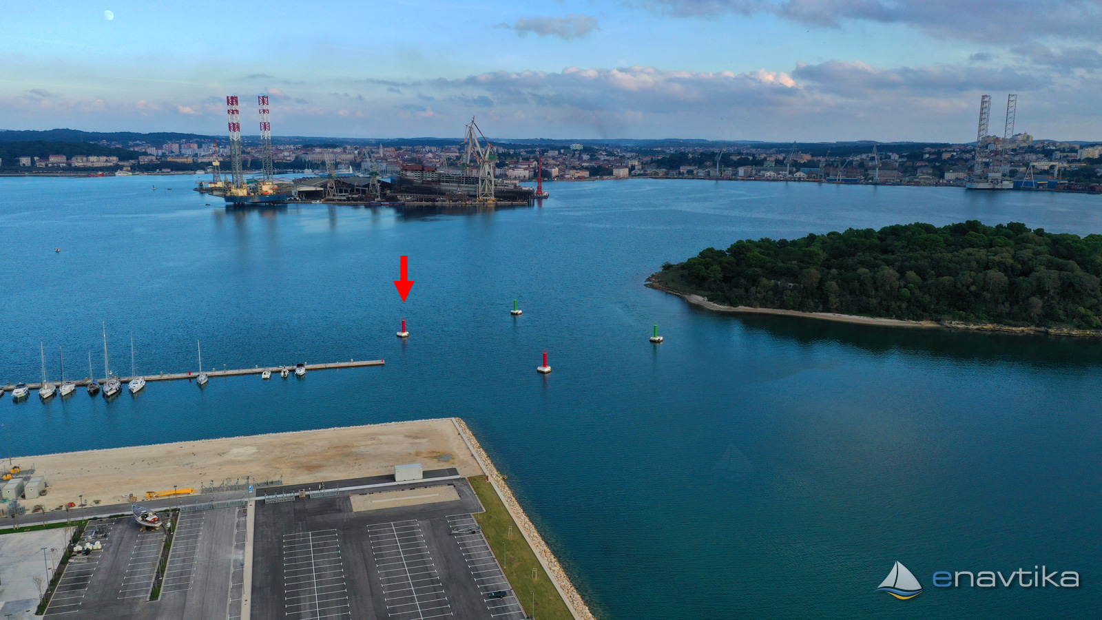
 Svjetionik
Objavil(a) eNavtika
, 16.09.2024
Podaci
| GPS | 44° 52' N , 13° 49' E |
| Dubina vode | 9m |
| Radno vrijeme | 1.1. - 31.12 |
| Mjesto | Pula |
| Karakteristika | R Fl 2s 6m 1M |
Info
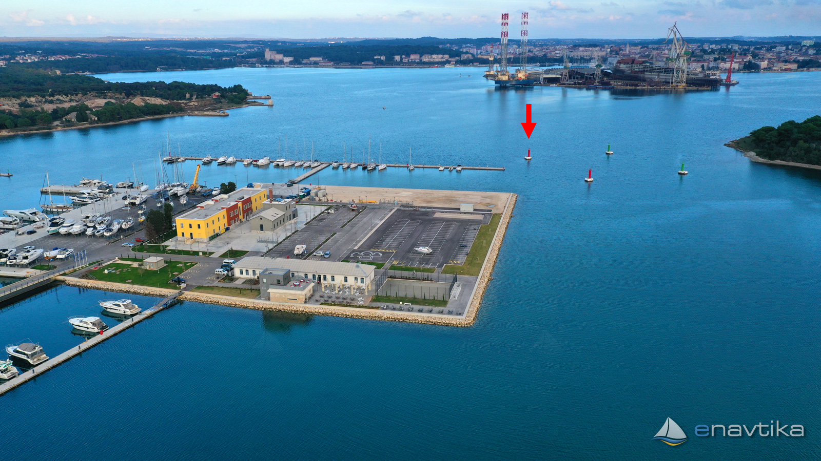
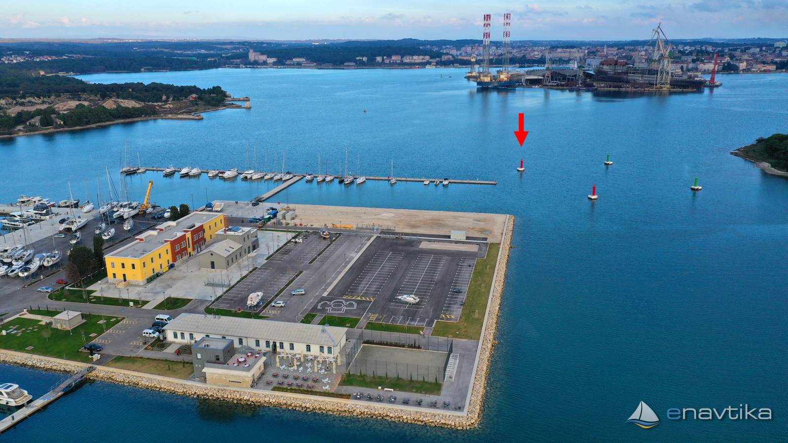
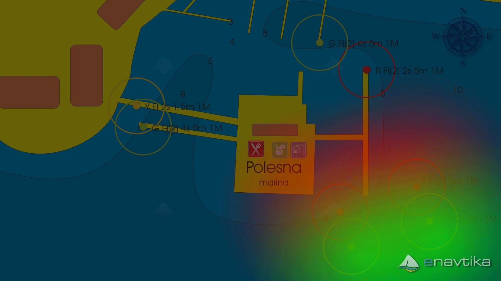
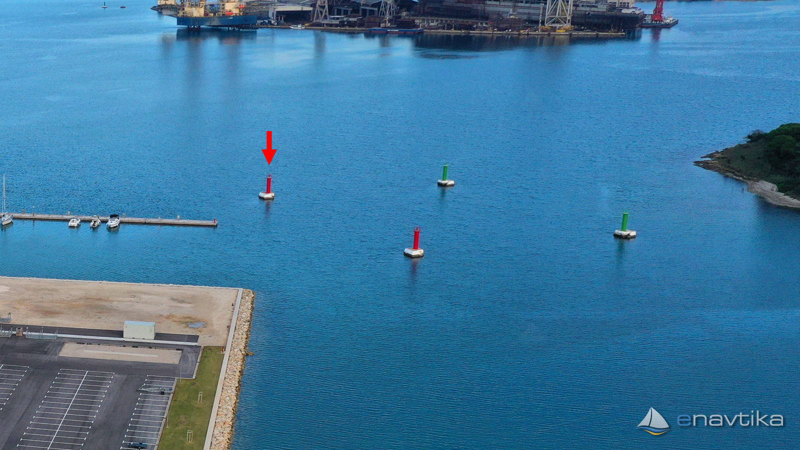
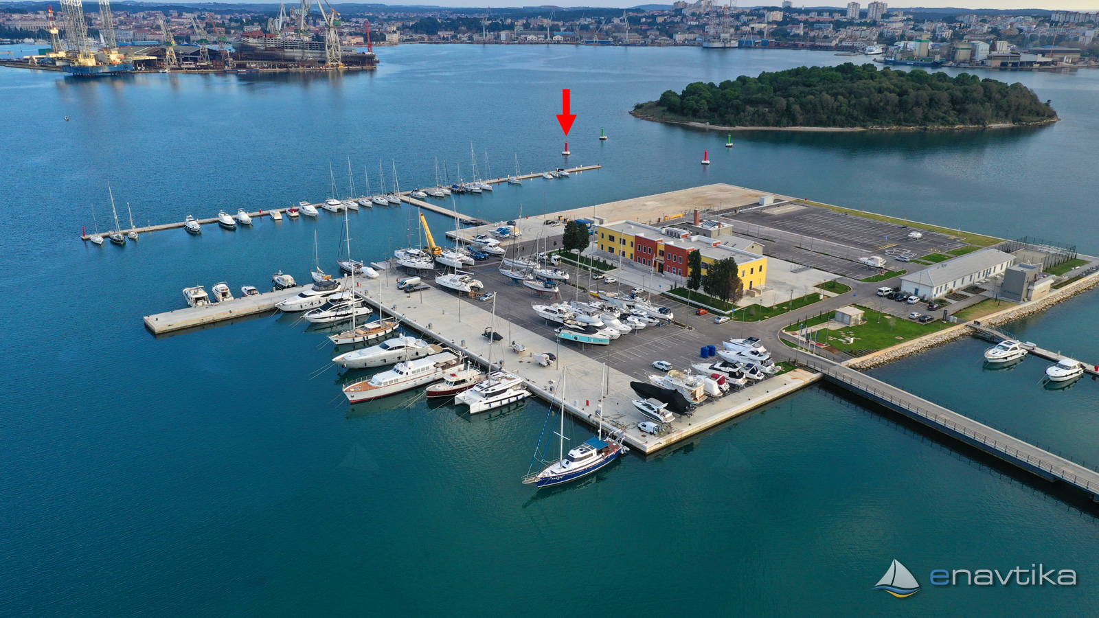
Mark no. 117 stands between the island of Sv. Andia in the southeast and the islands of St. Katarina on the northwest side. With the markings 116, 118 and 119 (two red and two green), it indicates a safe waterway between the two islands. The sea depth between the marks is 9-10 m. When sailing towards the marina, we must leave the red marks on our left and the green marks on our right. The red iron structure stands on a concrete pillar. The light is at a height of 6 m above sea level. It emits a flash of red light every two seconds. The characteristic of the mark is R Fl 2s 6m 1M.
Vrijeme
Danas
- čv
Sutra
- čv
Srijeda
- čv
U blizini
-
 Andrija 119
Svjetionik
0.04 nmi
Andrija 119
Svjetionik
0.04 nmi
-
Andrija 116
Svjetionik
0.04 nmi
-
Andrija 118
Svjetionik
0.06 nmi

Komentari