

Foto
Betina G
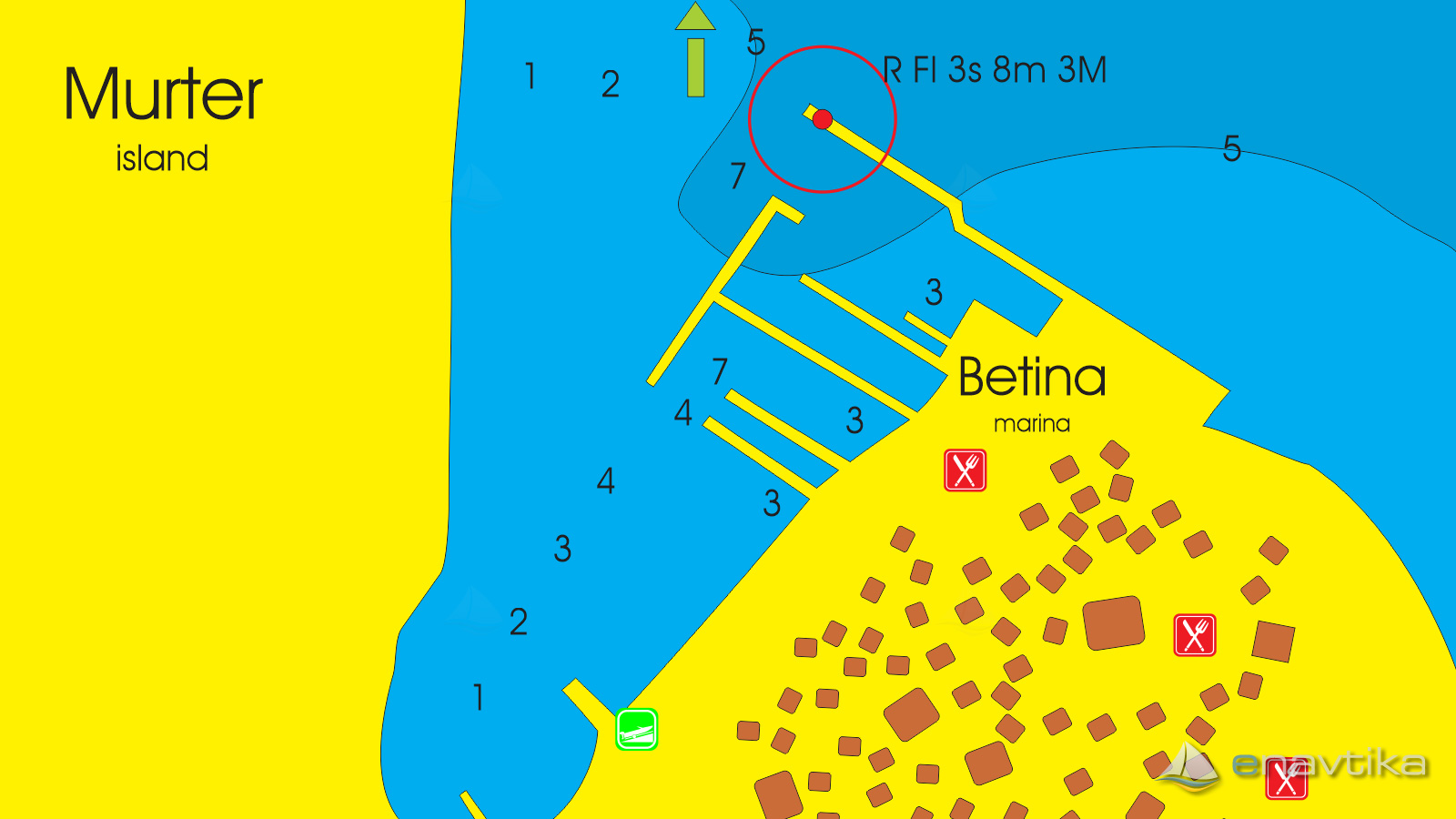
Murter
 Svjetionik
Objavil(a) eNavtika
, 11.05.2020
Podaci
| GPS | 43° 49' N , 15° 36' E |
| Dubina vode | 4 m |
| Mjesto | Betina (Murter) |
Info
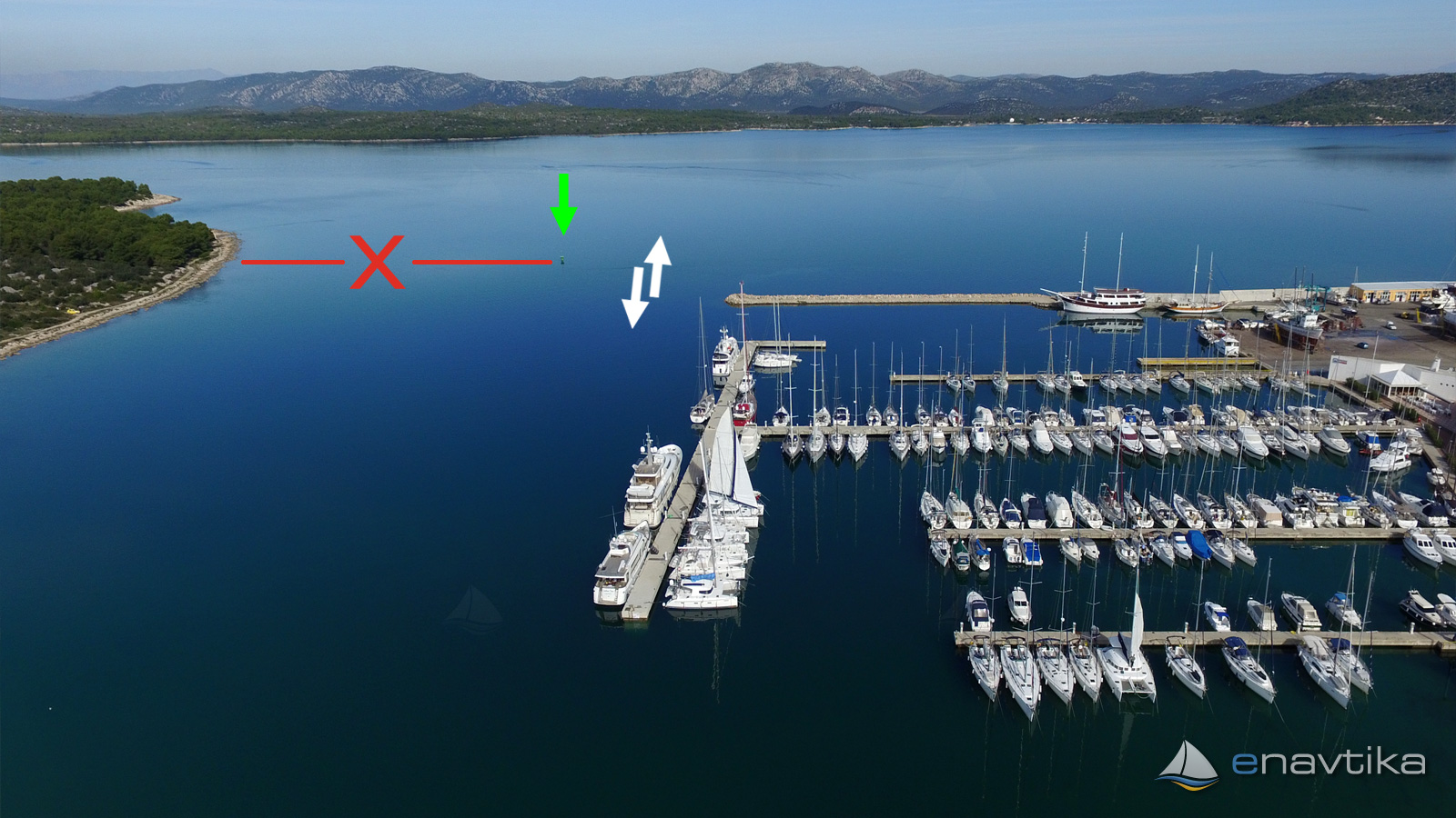
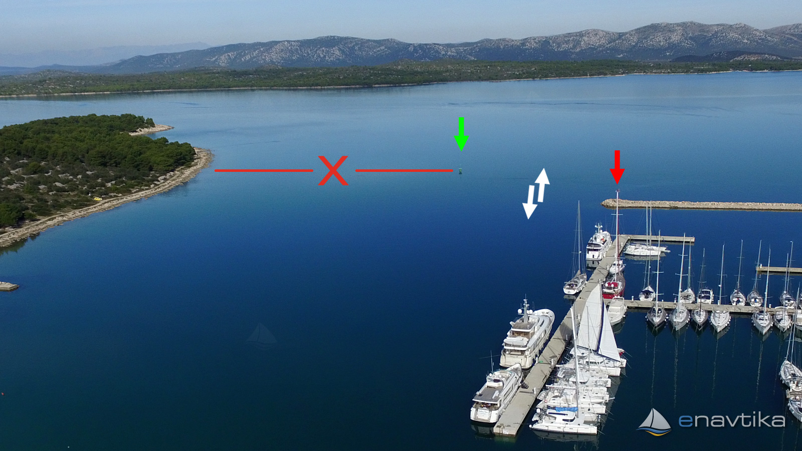
Green lateral mark stands 150 m east from the shore of the cape Gradina. With red lateral mark on the wave breaker of marina Betina it marks the safe way to navigate to the marina. It is necessary to sail between the marks from the northeast direction. Water depth between green lateral mark and shore is less than 2 m.
Vrijeme
Danas
- čv
Sutra
- čv
Srijeda
- čv
U blizini
-
 Betina E3209
Svjetionik
0.08 nmi
Betina E3209
Svjetionik
0.08 nmi
-
 Betina
Marina
0.18 nmi
Betina
Marina
0.18 nmi
-
 Dodić
Servis
0.24 nmi
Dodić
Servis
0.24 nmi

Komentari