
Video
Foto
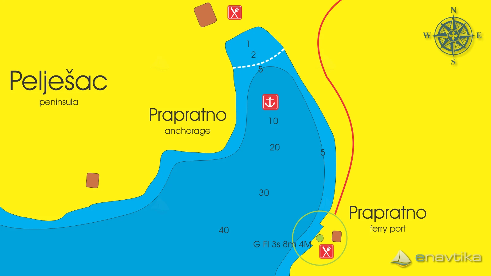
Prapratno
Pelješac
 Sidrište
Objavil(a) eNavtika
, 18.08.2025
Podaci
| GPS | 42° 48' N , 17° 40' E |
| Broj vezova | 0 |
| Dubina vode | 5 -20 m |
| Radno vrijeme | 1.1. - 31.12 |
| Mjesto | Prapratno, Pelješac |
| Benzinska postaja | 5 nmi Sobra (Mljet) |
Info
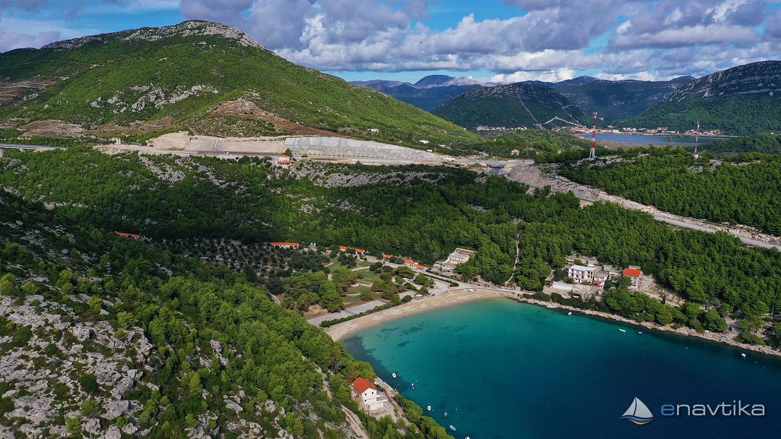
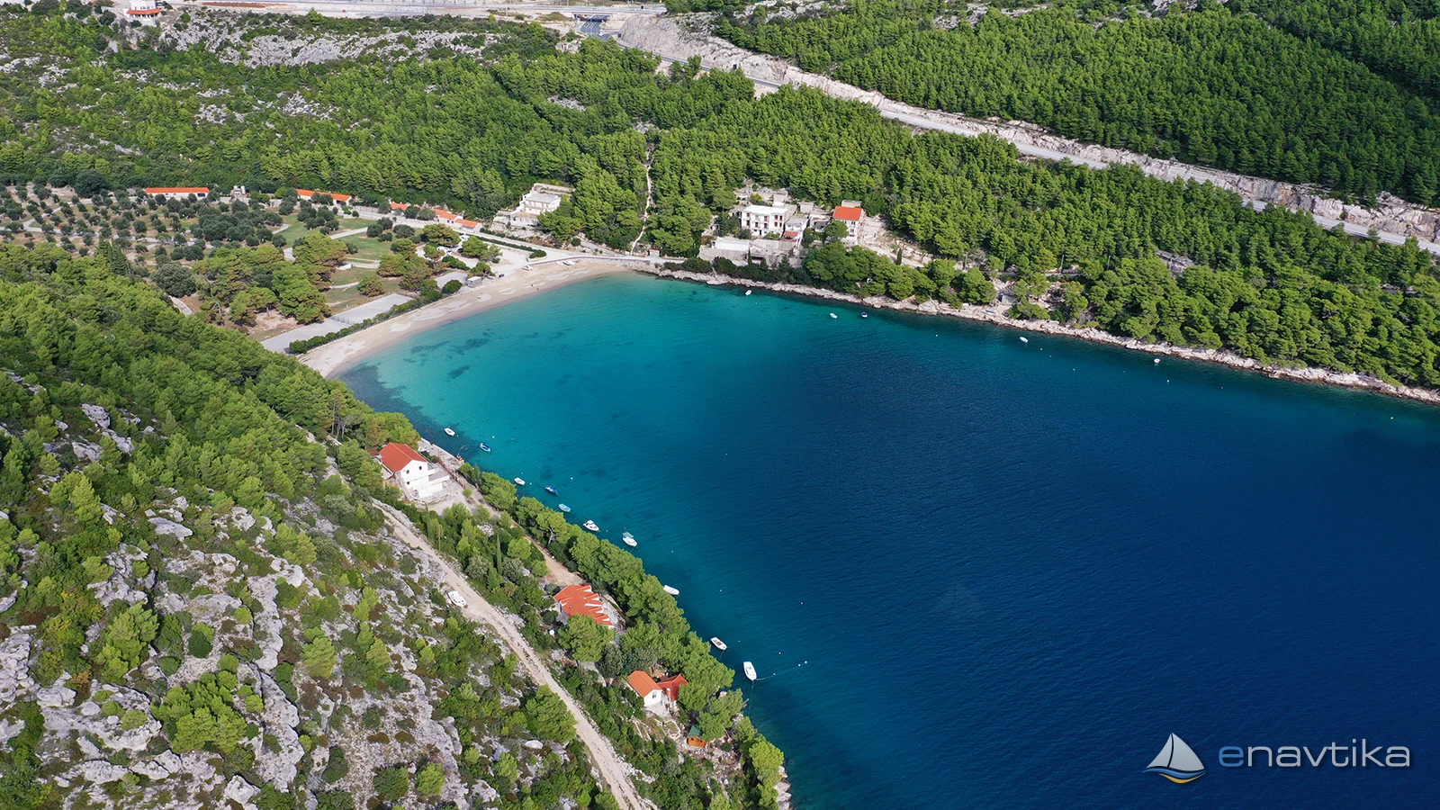
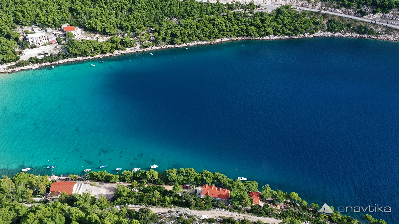
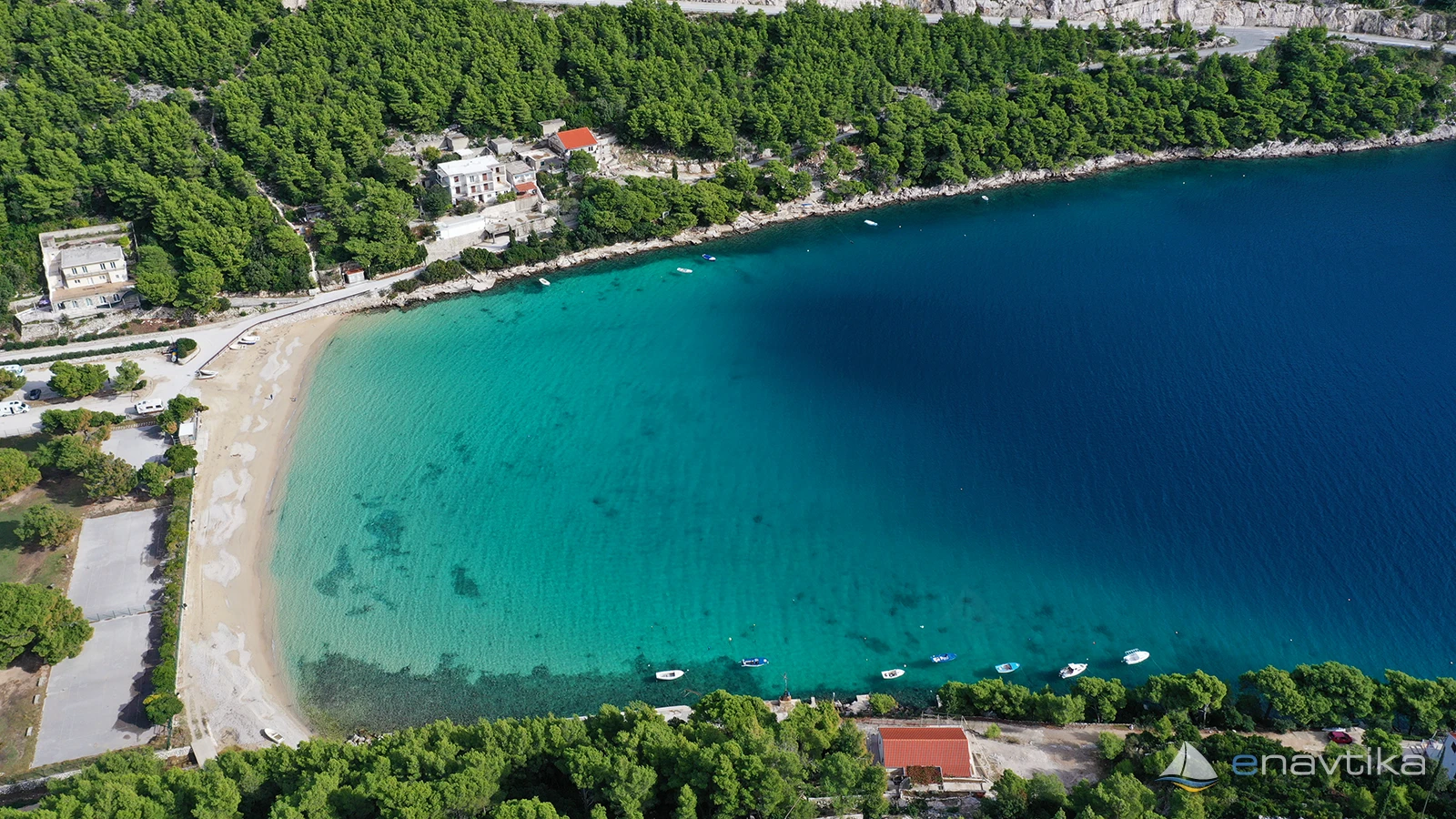
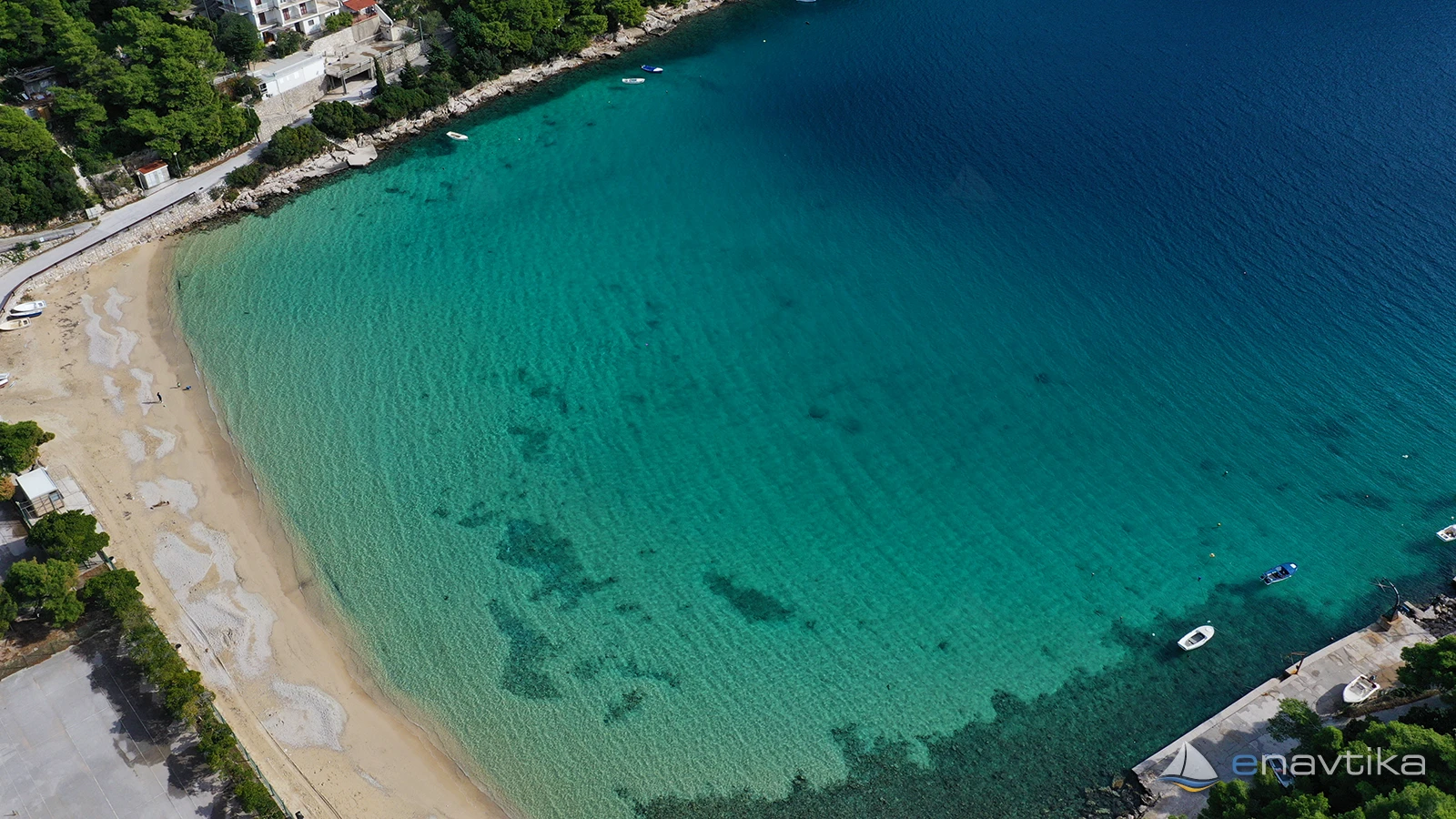
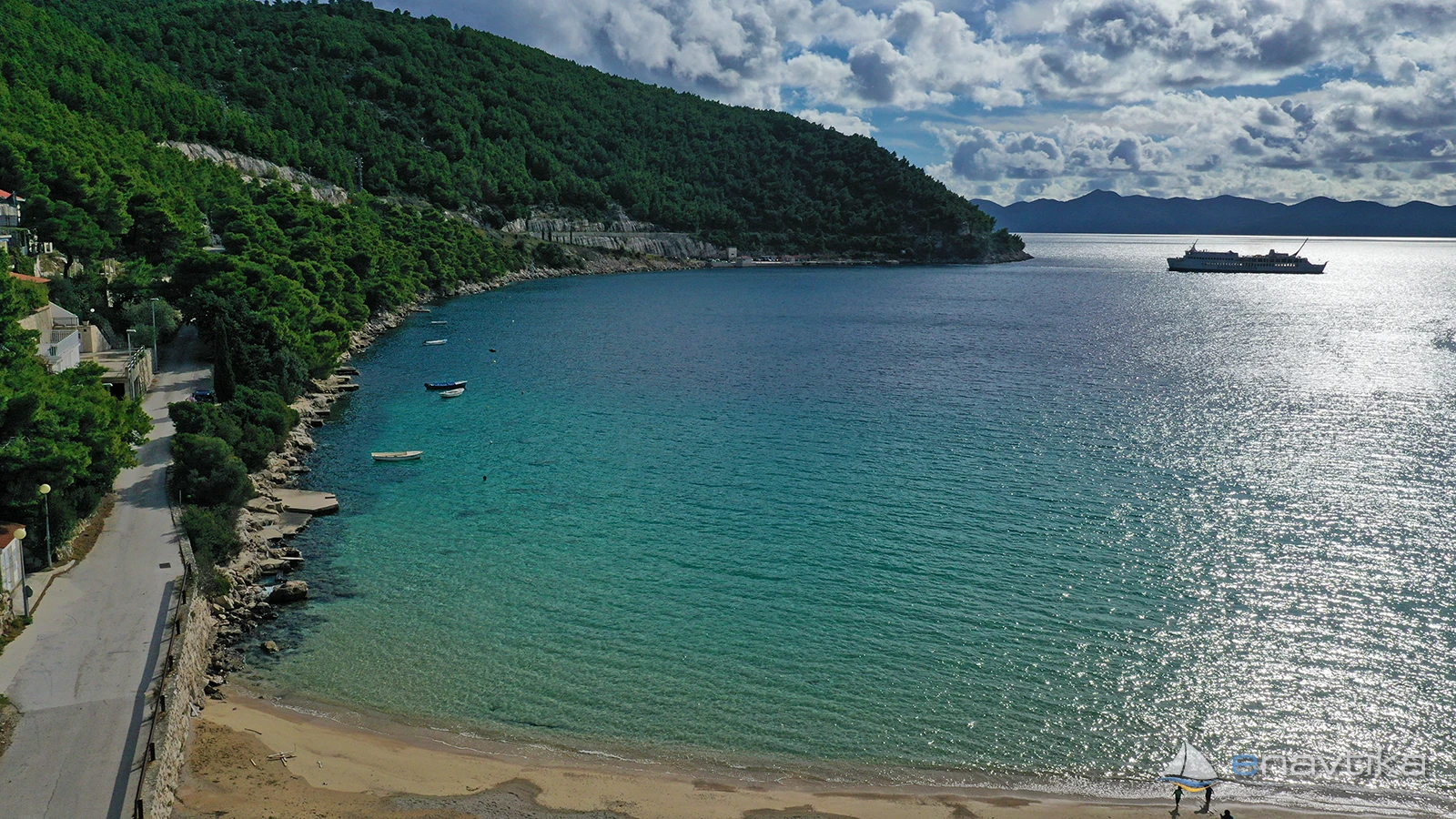
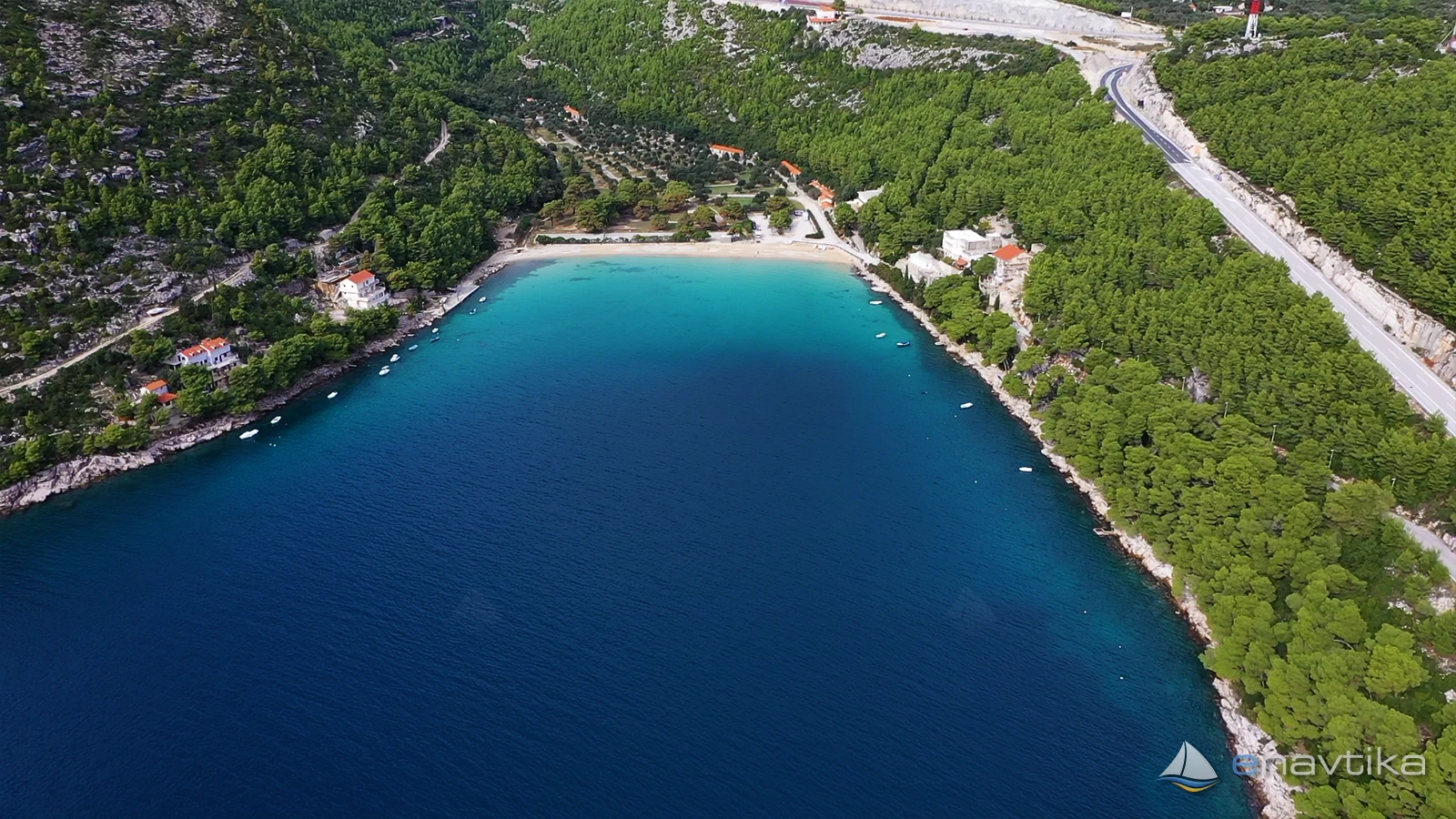
Prapratno Bay is located in the southwestern part of the Pelješac peninsula, next to the ferry port that connects the island of Mljet with the mainland. The bay is well protected from all winds except the south. Depths are between 5 and 20 m. The bottom is sandy and partially covered with marine vegetation. There is a campsite in the northern part of the bay. The sandy beach is fenced, so anchoring is possible at depths greater than 5 m. There are inns in the campsite and in the ferry port. The nearest gas station is in Sobra on the island of Mljet, which is 5 nmi away. No concession has been granted for the bay. There is no fee for anchoring on your own anchor.
Zaštita od vjetra/Vrijeme

Danas
- čv
Sutra
- čv
Srijeda
- čv
U blizini
-
 Prapratno
Luka
0.25 nmi
Prapratno
Luka
0.25 nmi
-
 Prapratno 697.4
Svjetionik
0.28 nmi
Prapratno 697.4
Svjetionik
0.28 nmi
-
 Soline Ston
Zanimljivost
1.33 nmi
Soline Ston
Zanimljivost
1.33 nmi

Cijene
| 18.08.2025 | 0,00 EUR/m |

Komentari